Oh Moab, two days was not enough!
We’ve been to Moab several times, although more times than I’d like to admit, our only stop was for gas.
 Our first time in town was technically a drive through on our way from Park City to Telluride. Yes, staying on I-70 to Grand Junction then south was the faster and more direct route but we wanted to check out Arches National Park along the way. It was a hiking trip loop that started at the Grand Canyon North Rim, then to Zion National Park, a quick stop in Park City for a golf tournament, followed by Arches all finishing in Telluride for their Bluegrass Festival. We bought the Park Pass for the year and we were going to get our monies worth.
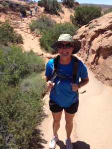
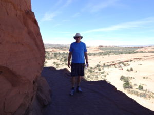
It was a quick trip through Arches as we wanted to get to Telluride before dark. That meant we only had a few hours to see as much as we could. We drove through the park stopping at several arches, both still standing and fallen, along the way to the trailhead for Delicate Arch. We see it on Utah license plates and it stands at the finish line for the bobsled track at Utah Olympic Park so it was time to see it in person.

It was a warm day in mid June but we were ready with lots of water. It was a nice hike back to the arch totaling close to three miles round trip. The trail is not hard but be prepared. There wasn’t much shade and I’m glad we didn’t leave our hats in the car. We found a cute little lizard on the trail and he was nice enough to stay still for a picture.
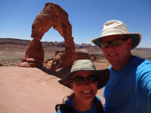

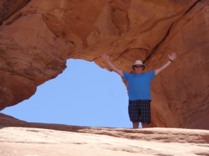
We walked along the trail on a ledge then turned to the right. There it was, the Delicate Arch. It was a lot bigger than it’s image in Park City. Even in the afternoon sun, it stood pretty and majestically. We took a lot of pictures. Pictures of the arch from many angles, selfies in front of the arch and pictures of people playing near and under the arch. Looking at it was fascinating when you realized how long it took to form. After leaving the arch and the park, we gassed up and headed to Telluride.
We drove through again on our way to ski in Beaver Creek. We were due for more than a few hours in town.
This trip would be that time but as we drove away early Saturday morning, we realized we needed more time on our next visit.
The drive from Breckenridge didn’t take long so we arrived at camp with plenty of time to hit a trail or two. After we were set up and the dog walked, we packed up some water and snacks and headed out on our adventure.
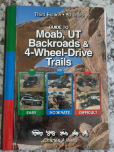
Just like Breckenridge, our Bible so to speak was Guide to Moab, UT Backroads and 4-Wheel Drive Trails.

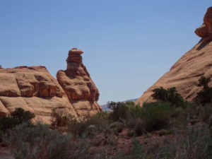
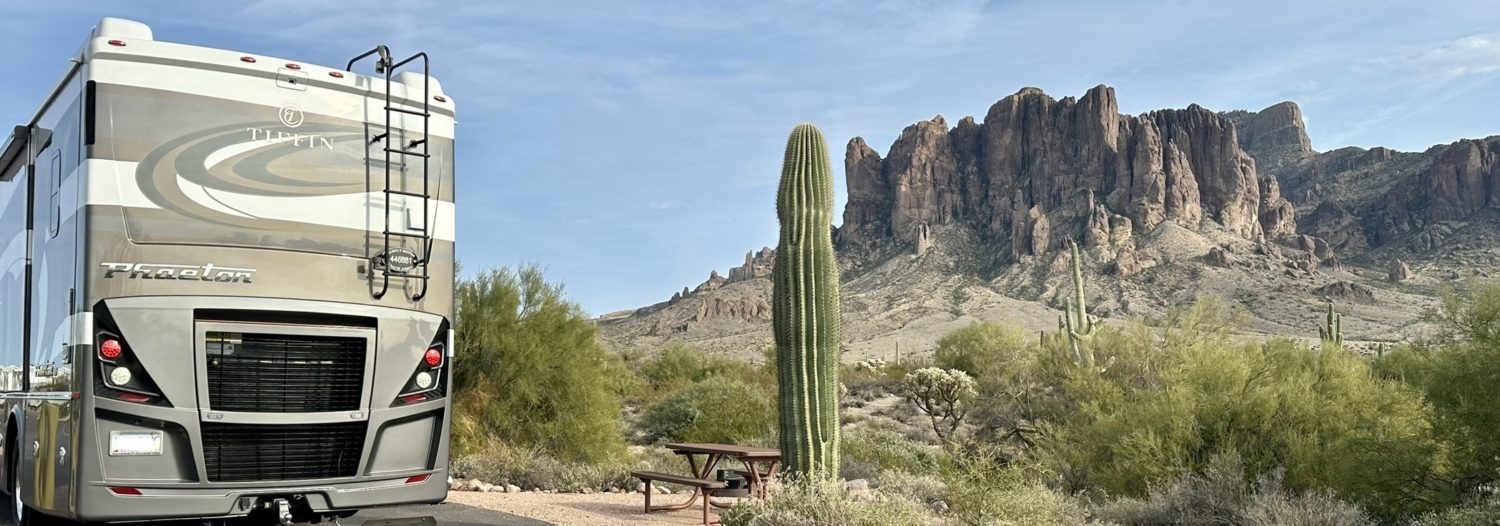
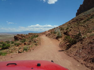
Gemini Bridges was first on the list. The trail head is not far from the heart of town, just a little north of the entrance to Arches. It’s an easy trail with some stretches of manageable rocks. Before we hit the giant Gooney Bird Rock, we saw a sign for an arch and detoured into a canyon where we found a giant state camp ground. Not giant in terms of number of spaces but giant because it went the entire length of this canyon and the spaces were huge. No way would we have been able to get our Phaeton back there but for tents or a small trailer it would be a fun place to camp. We could not find the arch. We looked and looked and looked. Then on the way out, almost back to the Gemini trail we spotted it. A small arch way up high on the right side of the canyon and could only be seen while exiting. We snapped a picture of the Gooney Bird Rock and ventured on down the trail.
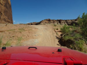 We hit the intersection with Bull Canyon on our left and decided we wanted to see the bottom of Gemini Bridges. That was a fun little detour. There were some fun steep parts that we went up and down on. In some spots you could see where the more adventurous off-roaders had traveled. Our Jeep is my daily driver so we keep it pretty tame on the trails. Just like in Breckenridge, we had this trail all to ourselves. We reached the spot on the trail where we could hike the rest of the way to the bottom of the bridges. It was hot, we had no cell signal and Mark left his weapon in the RV. We got out and walked a little bit before being spooked by a lizard scampering across the trail. It was then that the thought of seeing a snake hit both of us. This wasn’t very smart so we decided the best seat to see the bridges was going to be standing on top of them. As we got in the Jeep, we both said that we’d be back for this trail in the winter. Back up and over we went to the Gemini trail.
 In no time we reached the little parking lot for the walk to the bridges. Camera in hand we walked out onto the rocks. I still had snakes on my mind so I was careful not to step too close to a bush or near larger cracks among the rocks. We thought we were going the correct way but I kept hearing voices to my left. We kept on walking and I kept hearing those voices. We had to be going the wrong way. And, if we were going the wrong way, then the footprints we saw in the dirt were old. Which meant we were somewhere that hadn’t been walked in a while, which meant snakes. Just a few strides after hearing voices to our left again, we changed course. Just like magic, we saw teal colored stripes painted on rocks in a group of lines, like they were leading us somewhere! We sure weren’t at our best, hiking wise, in those few minutes. Those lane-line sized teal stripes led us right to the Gemini Bridges.
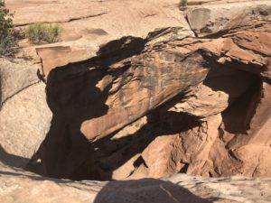
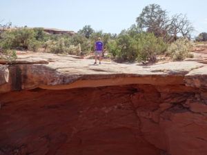
 What a sight they were. I still want to see them from the bottom but from the top, it was pretty cool. We had the place to ourselves; the voices I heard were a small group as they were leaving. We walked around the bridges, taking pictures and peering down below. I am not afraid of heights at all but the slope of the rocks rattled me a bit. They were sloping down, toward the edge and I couldn’t get comfortable enough to stand right on the edge. Mark thought it was pretty funny. He’s the one that tells me to get away from the edge. I jokingly mock him like Julia Roberts’ character did to Richard Gere in Pretty Woman. “Look Ma, no hands” as she leans back on the hotel patio. There would be none of that today.
Back to the Jeep we went to continue our ride. It was a pretty quick ride to the end of the trail at Highway 313, but we weren’t done.
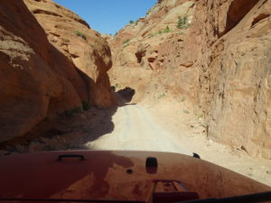 Long Canyon would be our trail leading us back towards town. It’s another easy trail with some fun parts along the way. The first fun part was Pucker Pass. The trail got pretty narrow, not too narrow, but just enough to pay attention. We didn’t have to pull the mirrors in, we passed through just fine.

A little after that was a giant rock laying across the trail. This rock was as big as a house but the fun part was going to be driving under it! Much like our river crossings, this was going to be videotaped. I hopped out and scampered down to the other side of the rock. It looks so flat in the video but it was steeper than I expected and the dirt was really soft. Once in place, I signaled for Mark to come on down. The space looked so small while we drove up to it, but the Jeep cleared no problem.
 I like to find faces and other things in rock formations no matter where we are. I can spot a person or an animal just about anywhere. Mark, on the other hand, struggles with this. The ride down Long Canyon was no different. We saw the beginnings of an arch being formed. We see stuff like this all the time at Lake Powell but this one was more defined than we’ve seen in a while. I wonder how many hundreds of years it will take until it’s a complete arch all the way through.
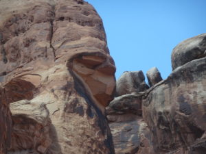
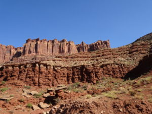
We also saw a lady with a giant basket of fruit on her head. I say we loosely. I saw it, he still doesn’t. Then there was the large group of people staring down on us as we descended farther into the canyon. You see it, right.
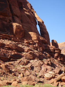
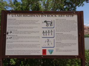
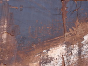 The last thing to see right at the end of the trail is Jug Handle Arch. From there we were on Highway 279 winding next to the Colorado River heading back to town. It was late afternoon and the rock climbers were out. They climb right next to the highway but everyone we saw was just getting started so we didn’t get to see anything death-defying. Also along 279 you’ll see a small sign on the right that says Indian Drawing with an arrow pointing left towards the rocks. Of course we had to check it out. There, on the rocks about 10 feet up is a series of drawings. They spanned probably 40 feet across on the rocks. It’s a neat peek back in time. By the height of the drawings you also can see right in front of you just how much the Colorado River is still carving the canyon.
Back at camp we got to hang out with two families we met online through a Tiffin Jeep group. We shared our Moab and RV adventures in the not so cool evening. We’re used to the dry heat long after the sun goes down but it was unusual for our new friends.

Our next day was big, hitting two parks. We started with Dead Horse Point State Park. It’s really a cruel story. According to legend, cowboys rounded up horses and herded them across the narrow neck out onto the point. They then piled up old branches and brush which created a natural corral. From there the cowboys picked the horses they wanted and left; leaving the rest to die of thirst. Standing out on the point you have to wonder what went through the horses minds when they could see the river below them with no way to get there.
While standing up there we could see a bunch of trails down below, all part of Potash Road which we were heading to next. Looking far out were giant bright blue pools; completely out of place in the brown and red colors of the surroundings. We learned that it’s a company called Intrepid Potash. In a nutshell, river water is pumped into the mine and dissolves the potash, after which the brine solution is pumped to evaporation ponds. From there, it becomes fertilizer. Who knew.
 We left Dead Horse and headed to Canyonlands National Park. Not far after the entrance, we turned left and started down the Shafer Switchbacks trail. Our handy guide starts at the bottom and goes up into Canyonlands but we were doing it top to bottom. I have to say, looking down at the switchback trail was impressive and I’m glad we did it this way, regardless of the $30 entrance fee. It’s no wonder we saw so many Jeeps coming towards us on the trail; they were going the free way! Lesson learned.
It’s another easy trail with some ruts, rocks and bumps along the way. There are several side trails and I think we explored them all.
I’m not going to lie, the switchbacks were tight, steep and fun! There was a white pickup truck with a bike rack on the back behind us and I’m sure some of the turns were too tight for him. I’m sure he had a few three-point turns coming down.
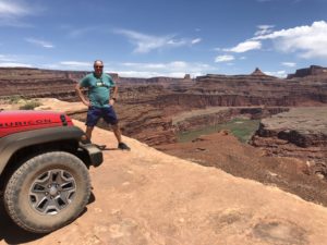

 At the bottom of the switchbacks we turned right onto the White Rim Trail. Our goal was to find Musselman Arch. We did, but not before finding one of the prettiest places to stop for lunch. While heading to the arch we saw a car parked in front of a little sign that said River Overlook. We parked off to the side, started walking and promptly saw tire tracks, a lot of them. The car in front of the sign was actually parked smack in the middle of the trail! We hurried back to the Jeep and drove around the car and made our way up the trail. We followed the tire tracks through the dirt and maneuvered over rocks until we reached an upward incline that we couldn’t see the other side. Good thing we did; about 30 feet in front of us was the edge. A straight-down-you’re-going-to-die edge. It was so cool to look over and see the river below! I slowly guided Mark closer and he parked the Jeep 10 feet or so away. This was our spot for lunch. Again we were all by ourselves in this beautiful spot. After lunch we walked around a bit taking pictures. There was another big rock nearby and I went out on it to take pictures of Mark and the Jeep. We joked that it should be a commercial picture the way the Jeep was pointing towards the edge of the cliff.

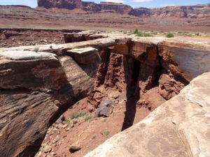
We headed back down the trail and drove another 1/2 mile until we saw Musselman Arch. I’m sure that’s a spot where many trail riders stop for lunch but I liked our spot better. It looks like a piece fell from underneath recently. I wonder how much longer it will stand as an arch.
Our next spot to see was Thelma & Louise Point. If you’ve seen the movie, you know the ending. They drive that pretty convertible off the cliff! We found the spot but now we need to watch the movie again just to see the ending. Later that night we found out that yes, they really did let that car go flying off the cliff. But, it traveled farther than they planned and stuck, nose down in the shallow river. A boat had to come get it out. I love movie trivia.
From there were on the hunt for Dead Horse Point. We wanted to see it from below. It took a couple of minutes and some zoomed in pictures to find the big shade structure that covers a large area on the point. It doesn’t look as imposing looking up at it from the bottom of the canyon.
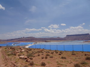
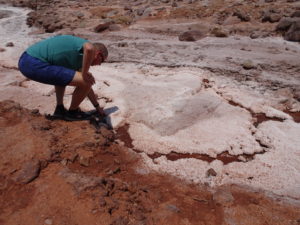
Then we got to those neon blue ponds we saw from above. What a strange sight. It was a windy day so the water was sloshing around in the ponds which led to the salt buildup on the far end. As we passed the last pond we came upon a salt river of sorts. We stopped to check it out only to find the white sediment rock hard. We tried to break it up in our hands like you would a clump of dirt but no luck. It was really hard as a rock. Odd. As we drove out I wondered why this was even allowed to happen.
When we exited the trail we were back on the familiar Highway 279 right next to the Colorado River. There still weren’t any rock climbers up high. We would have stopped and watched them for hours had there been any.
Our adventure in Moab wasn’t quite finished. We had a jet boat ride up river scheduled.
We saw the billboard while driving in town and knew we had to do it. If totally fits with our X-Games persona. Sometimes you just have to impulse buy on vacation.
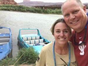

What a ride it was. If you haven’t done it, you need to the next time you’re in Moab. The people at Moab Jett couldn’t be any nicer. Jason was our boat driver and he did not disappoint. Mark realized pretty quickly as we were lined up to get in the boat that it was loading back to front. He is normally the guy that likes to be in the front at all times so I was a little confused when he held my arm and we stayed in the very back of the line. What was going on? It took me a few seconds to figure it out, we were waiting to be last and get the best seat of the ride. Not only is he super tall and handsome, he’s also pretty smart.
Our electronics were safely stowed in a waterproof bag under our seats. Mark decided that pictures and video were in order. I read the online brochure. It specifically talks about how wet you will be. Why, oh why did he keep taking his phone out but I am sure glad he did. In addition to the pictures you get from the company, we had front row seat videos of the fun.
You can see the video Mark made on his YouTube page.
Jason zoomed up and over rapids, did more 360 spins than I expected and stopped to let us float while he talked about our surroundings. He pointed out hikes to do on another trip, beaches along the river to relax on and a few wild places he rock climbed. We zoomed up a rapid, did a quick 360 then pointed the boat back into the wake-wash where he buried the nose and drenched us all. Be prepared when you take this jet boat ride; you will get wet. I’m not talking a little splash that messes your hair up; I’m talking taking a ten minute shower with your clothes on wet. It was so much fun! Thankfully it was a hot day as we dried in no time. Of note, they do have rubber suits you can wear in colder weather.
Just like that our Moab adventure was done. We had a long drive ahead of us with a four-night business trip on the horizon. Leaving Moab at 6:30 in the morning was hard, I could almost hear another trail saying, “Wait! You missed us!”
Next time for sure.
