Our first Fourteener! By car so it doesn’t count.
 This excursion was not going to be cut from our trip.
When we started planning our trip we planned on taking the cog railway up to the top and were supremely bummed when we found out they company closed due to the age of the railway. I sure hope they can get help from Switzerland for new equipment and operational advice. Our trip to the top was going to have to be by car. Hot tip when you get to the gate with the lines of cars; pay the attendant that’s walking car to car with cash then you can drive right on through. The reason for the hold up is paying by credit card.

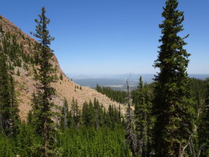
The drive up is pretty. It’s a 20-mile drive that climbs over 6,000 feet. The map inside the pamphlet marks many points of interest along the way. There are lots of pull-outs to stop and take pictures from. The speed limit is 25 the entire drive
Between mile 3 and 4 there is a Big Foot Crossing sign. Apparently he has been spotted several times on the mountain. We didn’t see any sign of him. At mile 6 is the Crystal Reservoir Visitor Center. There are three reservoirs you can see along the drive. The other two are South Catamount and North Catamount, which can be seen off to the right at various points along the drive. It was a hazy day due to smoke from the 416 Fire in Durango so the view of the reservoirs wasn’t as pretty as I’m sure they are on a clear day. We also passed a ski area on the left near mile twelve.
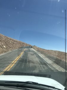
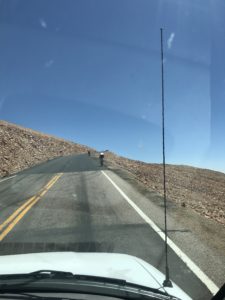
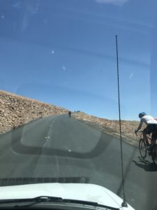
A wild sight was several cyclists riding up (UP!) the mountain. Twenty miles with an 6,315 foot elevation gain. That is a huge ride. We are big fans of the Tour de France race and we likened these riders to the race leg that finishes at the top of Alp D’huez. Mark talked to a couple of them at the top; both said it took them four hours to make the climb. Talk about a big calorie burn.
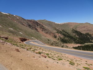
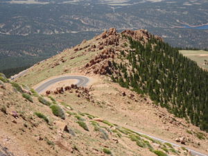
After mile 13 the climb gets steeper. There are a series of switchbacks between mile 13 and 16. The views were far and wide, albeit a little hazy from the fire. There is a big construction project at the top so we had to park the Jeep at mile 16 and take a shuttle van to the top. We arrived on top with big work trucks and cranes and large areas marked off with construction tape. They are building a brand new summit house and observation deck complete with a bigger parking lot. We talked to some of the workers and were told the project should take three years to complete, weather permitting of course.
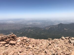
 The top! We got out of the shuttle van and looked around past the construction and out at the vast distance. We were seriously at the top of the world. Well, the top of this general area at least. It was breezy, nothing like the wind we had at the top of Peak 10 the day before. The haze from the fire in Durango was more apparent at the top which was a bummer. Bummer that we couldn’t see far as clearly and a big sadness for what was happening in Durango. We’ve spent time there and it’s a beautiful part of Colorado that’s been altered for many years.
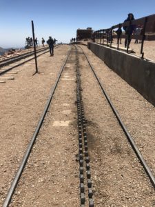
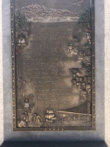
After taking our picture at the Pikes Peak sign, we walked around the back of the current summit house. There sat the lonely cog railway tracks missing their rail cars. We walked up onto the new observation deck and stood before the plaque for Katharine Lee Bates, writer of God Bless America. She was inspired to write it from her visit to the top of Pikes Peak in the summer of 1893. While standing there reading the plaque I thought of what a long trip up the mountain it must have been way back then. Can you imagine? We also found the remains of a very old structure; I’m guessing it was the first summit house. Maybe even the one Ms. Bates saw on her trip to the top. Mark standing next to the door frame shows just how small it was.
 Summit house was our place for lunch and a little souvenir shopping. We bought a t-shirt for my dad and a Christmas ornament for our tree. Many years back ornaments became our souvenir of choice. I love pulling them out and remembering the fun we had every year while decorating the tree. When the boys were both still living at home we would talk about our favorite part of each trip the ornament represented. Good times.
We hopped into the shuttle van for our ride back to the mile 16 parking lot then headed down the mountain. There is a small guard shack at the Glen Cove at mile 13. Driving up the mountain you go right on by but driving down there is a mandatory brake check. If your brakes are too hot, you must park your car until they cool off. Mark kept the Jeep in the lowest gear so we didn’t need to brake much at all. The driver in front of us was fine as well. It’s an interesting tidbit on the mountain and a good safety measure. I would not want to lose my brakes going down that mountain.
While driving up we noticed lots of hay bales covered with a racing banner. We asked our shuttle van driver about it, thinking it was a bike race. Oh no…it’s a car race…up the mountain. It’s called the Pikes Peak International Hill Climb and racers come from all over the world. He said drivers come to practice in the weeks leading up to it. I looked it up when we got back to the campground and this years’ race is June 24th. That would be a blast to watch as they fly up the mountain. Maybe next year we can be there for it.
I can’t wait to go back when construction is done to see it again. Hopefully next time the train will be running again so we can get a different perspective.

